|
|
FORTRESS OF WISE KINGS
«Back to Home
«Hotels in Natal
«Entertainment in Natal
«Beaches Guide
Directions: Praia do Forte. Phone: 3211-4959
Entrance: in December 2004, adults paid R$ 3, and kids up to 12 year old paid R$ 1.50.
The fortress was finished on January 6h 1598, day of the Three Wise Kings; this page (in Portuguese) explains the meaning of the Wise Kings.
The construction took 30 years. The fortress was built right on the top of the reefs, to guarantee a solid basement (this means that the work could only be done during the low tide, which doubled the time of construction); material used included sand, bronze, whale oil and massive blocks of stone brought from Portugal. The architect, priest Gaspar de Samperes, adopted the conventional design for a maritime fortress: a five corners stars.
In 12th December 1633, the fortress was taken over by the Dutch, who stayed until January of 1,654, when the Portuguese, helped by the indians, regained the place.
Guides speak Portuguese; a few speak Spanish. Unfortunately, there are not guided tours spoken in English (or any other languague).
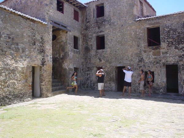
The photos below (click the images to enlarge) describe some of the interesting facts about the fortress.

|
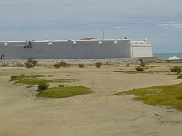
Location: the fortress is located in the northern extremity of
Praia do Meio. It is strategically positioned on one of the banks of the river Potengi; the Portuguese had a good view of attackers coming from the Ocean and from the jungle (indians).
|
|
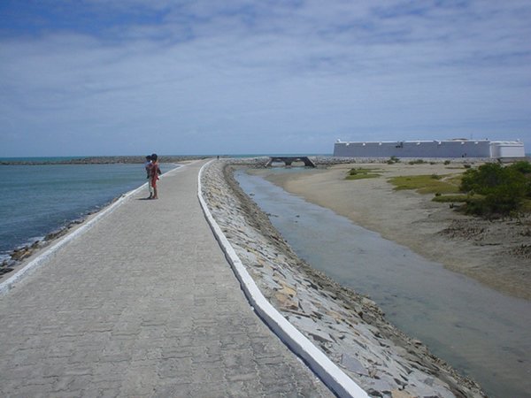
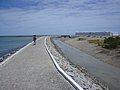
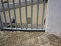
The car parking is at least about 500 m from the fortress (public parking only, along the streets); the pic shows the walkway until the fortress. Wear a hat or a cap. There are toillets, cafeterias and a small artcraft shop inside the fortress.
|
|
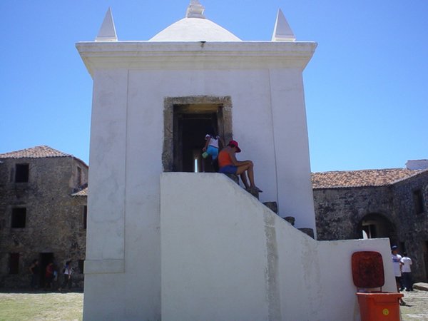
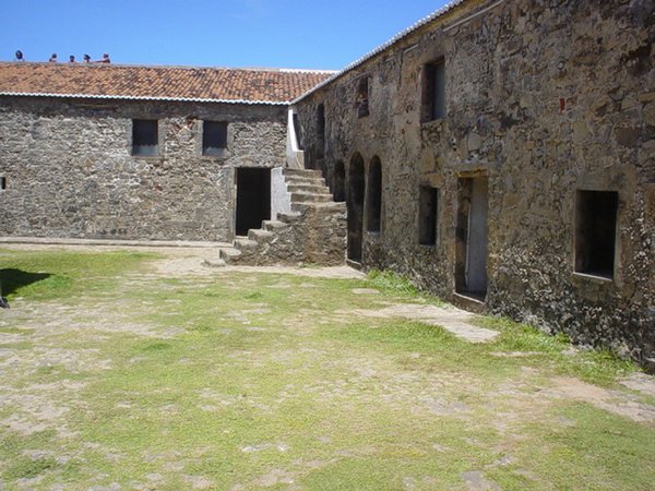
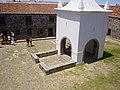
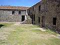
General view of the internal yard. The fortress is about 50 m x 50 m, with four walls. In the center, a small chapel (the architect was also a priest). In the middle of the chapel, there is a well, from which the soldiers obtained water; this water was a mixture from the river and the sea, hence a little (much?) salty; the commanders had a separated water supply (read below). On the background of the picture, the cells where criminals were confined.
|

|
This other angle shows the top of the chapel, where the Portuguese maintained the powder used in the cannons. The format of the building was designed in such a way that, in case of explosion (a cannon ball thrown by an enemy ship, for example), the explosion would go upwards, minimizing damages inside the fortress.
|
|
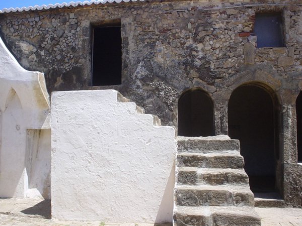
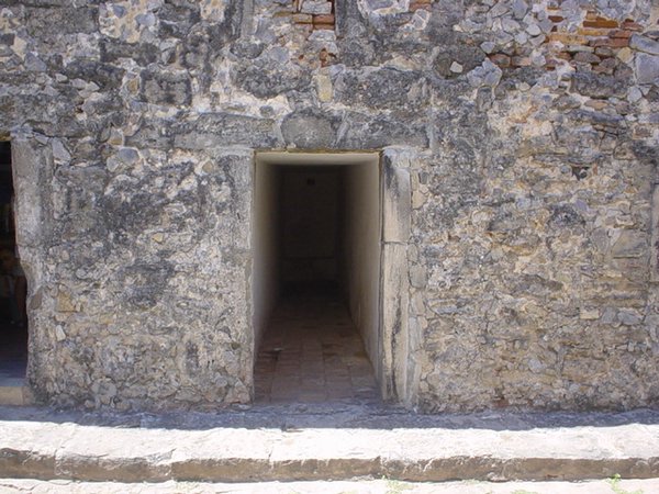
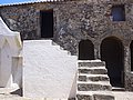
The fortress was unhabited by one captain, a few commanders and about 100 soldiers. This picture shows three things: a reservoir of water (upstair), collected from rain, reserved for the captain and commanders only; the soldiers drank water from the well. The door at the right is the entrance to the meal room of the captain and commanders (soldiers had to eat in the central yard); notice that the doors have circular archs, which were reserved for important places only; in the fortress, only these doors and the chapel had archs. To the left of the picture is the shooting wall; people were put into that gap and shot to death; the upper part of the gap has a place to fit the head of the person being shot, in case he was too tall.
|
|
This picture shows the soldier´s rooms (behind the stairs). About 100 soldiers were crowded into a 40 m x 10 m room (according to the guide, there used to be mezzanines). The soldiers rooms were built on the side closest to the ocean (the most dangerous of all); the wall of these rooms is 4 meters wide, of pure rock. To the right, the meal room of the commanders, and their "offices".
|

|
This picture shows the dorms of the captain and commanders (upper level) and some warehouses (floor level). The door behind the girl is the entrance to the dungeons, where men sentenced to death were kept; according to the guide, many people were killed in this room, mostly during the Independence Wars, circa 1822.
|
|
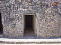
A secret passage. According to the guide, this passage should be used by the captain only, in case of emergency; the passage, which today has a blind end, would lead to a secret exit, where a boat would be waiting for the captain.
|

|
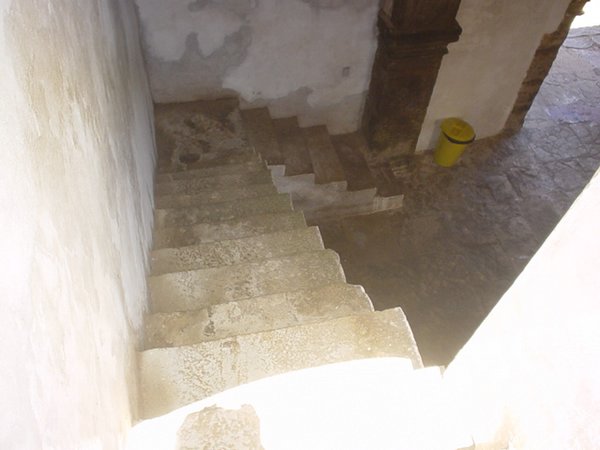
These stairs, next to the front door, lead to the upper level; it is 8 meters high, with no hand rails. It looks like this design was a tactic of the Portuguese: it would be easier for soldiers to push invaders downstairs, and the high fall would cause injuries. Other tactics: the main entrance has a hole through which the Portuguese would pour hot water; also, many doors have been carefully designed, so that their heights would fit the Portuguese soldiers, whereas the Dutch (taller) would have to duck.
|
|
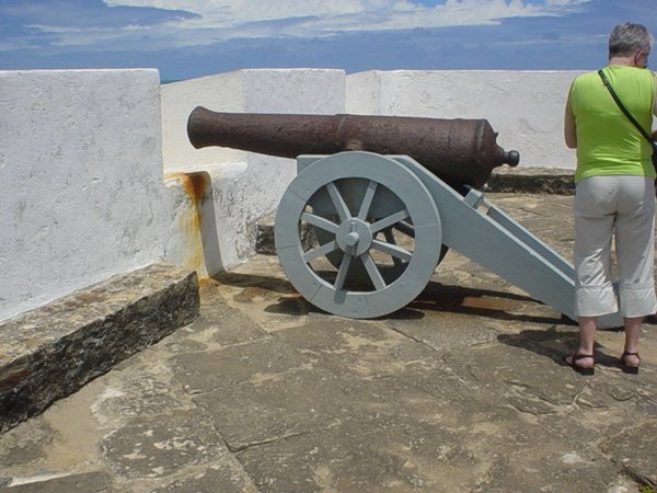
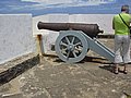
The cannons are originals from the 17th century (the wooden supports are not). There are cannons of 400 kgs (overlooking the river and the city) and cannons of 800 kgs (overlooking the sea). The wall are original, but are periodically re-plastered and re-painted. The rocks of the floor are originals, except for the small step, which was added latter.
|

|
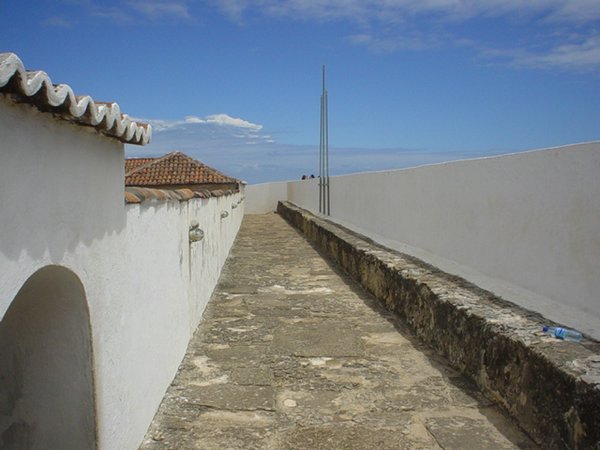
The upper corridors. This is the narrowest side, which overlooks the river Potengi. This corridor has the same width as the walls of the fortress.
|
|
This is the widest wall, parallel to the ocean; this is the roof of the above mentioned soldier´s room. In the irregular circular zone, there used to be a beacon, which was used during the World War II to guide the American hydro-airplanes which arrived on the waters of the river Potengi; in 1944, after the campaign in Africa had finished (and the American basis wasn´t used any more), the beacon was removed, and a small metal plaque (not visible) was left in its place. This beacon was replaced by Farol da Mãe Luíza.
|
|
The toillets. All the occupants of the fortress used this toillet; all "residuous" were thrown straight into the ocean. By coincidence or not, the toillet is built right above the secret passage, mentioned above.
|
|
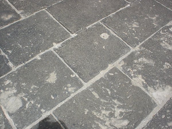
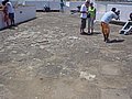
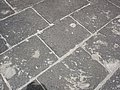
Notice how well conserved these original, 400 year old rocks are. These rocks are on the floor which guards the river and the city. It looks that the cannon balls which used to come from the sea were caused much more damage than the arrows which came from the river.
|
|
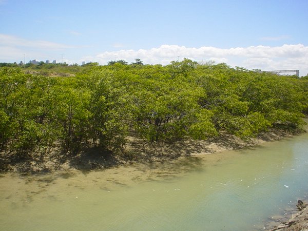
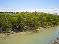
This picture is a bit off topic: it shows the "manguezais" (in English, mangroves) which used to cover the banks of the river Potengi, and many other areas of the Brazilian coast; manguezais are rich in fauna and flora. Most of the manguezais were destroyed, to clear space for buildings and shrimp farms; the neighbourhood of the fortress is a protected area, so the manguezais are still nearly intact.
|
Back to Top

visitors since April 5th 2005
|
|